Overview
In the 1950s, Arches National Monument Superintendent Bates Wilson began exploring the area that is now Canyonlands. He believed the area was worth preserving and started advocating for the creation of a second park near Moab. In 1964, Wilson’s goal was achieved with the creation of Canyonlands National Park.


Canyonlands is divided into four districts: the Needles, the Maze, the combined rivers (Colorado and Green), and the Island in the Sky. We only had one day to explore (and a rental car that wasn’t a 4X4), so we spent our day at Island in the Sky. The Island in the Sky is a broad, flat mesa between the Colorado and Green Rivers in the northern section of the park.

Shafer Trail
Shafer Trail is a rugged, backcountry road that requires high clearance and four wheel drive. Our rental car wasn’t going to handle it, but it was fun to look at and plan to drive on our next trip to Canyonlands!

Grand View Point
From Grand View Point, visitors can see the Maze district, the Needles district, and the White Rim. There are many nice overlooks on the Island in the Sky, but Grand View Point was our favorite.

Other Viewpoints
After checking out Grand View Point, we stopped at other viewpoints around Island in the Sky. Here are some of our favorite photos…


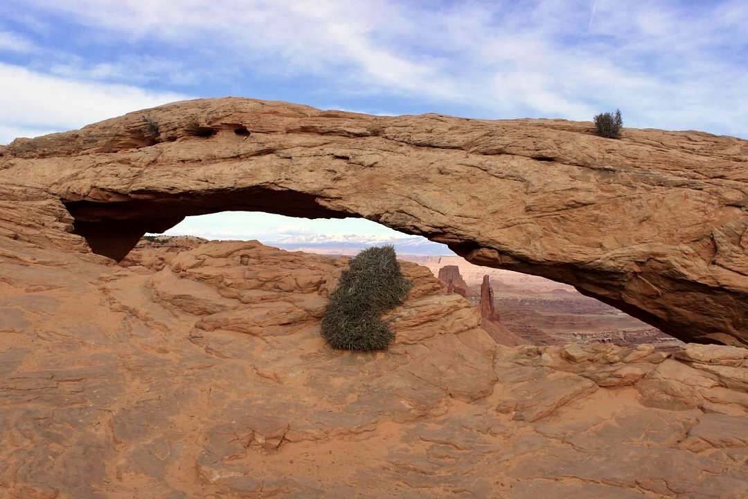
Mesa Arch
We finished our day at Canyonlands by hiking to Mesa Arch, which may be the most famous feature in the whole park! A short hike leads to the arch, which is perched on the edge of a cliff. The arch frames an amazing view of the canyons below it and the La Sal Mountains in the distance.


Check out our blog post about nearby Arches National Park here!
Click here for more Land of Liberty Explorers!
Like this page? Please pin it!


