Overview
Sky Pond is about 4.5 miles from the Glacier Gorge parking lot – making the total hike 9 miles out and back. The trail is rated strenuous and we definitely agree. This hike gains 1780 feet in elevation, which includes climbing a waterfall. The trail is rated as the best hike in the park by many rating services including hike734.

Trailhead
The hike to Sky Pond begins at the Glacier Gorge Trailhead on Bear Lake Road. Between May and October, a timed entry Bear Lake Road access pass is necessary to enter this section of the park between 5:00 am and 6:00 pm. We did not have a timed entry pass, so we got up early and arrived at the park at 4:00 am. We reached the Glacier Gorge parking area around 4:30 and snagged the last spot in the lot.
Alberta Falls
Alberta Falls is a 30 foot tall waterfall, and the first major landmark on the hike to Sky Pond at .8 miles from the parking lot. It is named after Alberta Sprague, who was one of the early settlers of Estes Park. It was still dark when we reached the falls, but the sound of the rushing water had us excited to see it in the daylight on our way back down the mountain.


Loch Vale
From Alberta Falls, hikers continue about 2 miles to the Loch. We reached the Loch shortly after sunrise and marveled at the gorgeous view. The Loch is a beautiful subalpine lake at 10,800 above sea level. Taylor Peak, Thatchtop Mountain, the Sharkstooth, and Powell Mountain are visible from the Loch. Taking the trail to the Loch alone would make for a great hike, but we had our sights set higher – we continued on the trail toward Sky Pond.


After the Loch, the trail continues along Icy Brook and the elevation gain becomes more noticeable. At 3.6 miles, hikers reach a fork in the trail. To the right is the trail to Andrews Glacier. Keep left to continue on to Sky Pond. Shortly beyond this point, Timberline Falls comes into view high above the trail. This is a good spot to take a break and have a drink of water. In the next .15 miles, the trail will gain 200 feet in elevation!


Timberline Falls
The base of Timberline Falls is about 4 miles from the Glacier Gorge parking lot. The Falls spills out of the Lake of Glass tumbling close to 100 feet, then trickling down the valley. The view of the valley is impressive. The Loch looks small from here.

The trail continues straight up the rocks to the right of Timberline Falls. Climbing the waterfall is a little scary! It requires the use of hand and foot holds and is complicated by water running down the rocks. The first 30 feet are the most difficult, and once that section is cleared it becomes a rock scramble with more options of where to step rather than a straight up climb. It was quite the thrill. We’re glad we did it!

Lake of Glass
Lake of Glass is a beautiful alpine lake at the top of Timberline Falls. Views of the Sharkstooth, Powell Mountain, and Taylor Peak are pronounced here. The trail is not well marked. Many hikers mistake the Lake of Glass for Sky Pond, and turn around. Instead take your time and look for the worn path to the right of the Lake of Glass, which scrambles up and over some boulders. Continue for about a half mile to Sky Pond!


Sky Pond
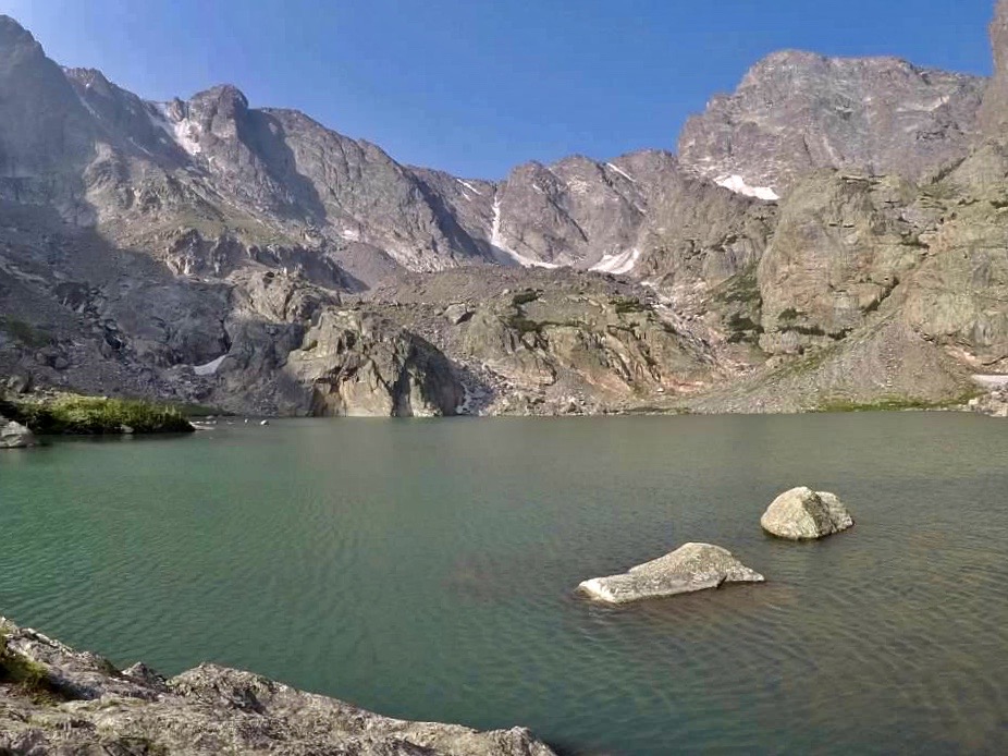
Sky Pond sits 10,900 feet above sea level and is surrounded on three sides by sheer cliffs. To the right, the Sharkstooth is an imposing feature. We enjoyed a well earned snack and bottle of water on the shore while we watched a mountain goat gracefully traverse the steep cliffs across the pond. Although the hike to get here was only 4.5 miles, the incredible scenery and elevation gain make getting here feel like an even greater accomplishment. Take some time here to enjoy the views before heading back the way you came.


Click here for more Rocky Mountain National Park pages!
Click here for more Land of Liberty Explorers!
Pin this page and enjoy your hike!


