Lassen History and Background
The Atsugewi Tribe called the area that is now Lassen Volcanic National Park home long before the first settlers arrived. In the mid-1800s, Lassen Peak became a landmark that helped settlers navigate their way to the Sacramento Valley. Eventually Lassen Peak was named for Danish blacksmith Peter Lassen, who served as a guide.

Lassen Peak is the largest plug dome volcano in the world and the southernmost volcano in the Cascade Range. Lassen Peak and the Cinder Cone were designated a national monument in 1907 by President Theodore Roosevelt. The area was elevated to a national park on August 9, 1916. The park is one of the only areas in the world that is home to all four types of volcanos: plug dome, cinder cone, shield, and stratovolcano. Between 1914 and 1921, Lassen Peak experienced a series of minor and major eruptions. Evidence of those eruptions is apparent throughout the park. The park’s main road was constructed between 1925 and 1931. In 2021, the Dixie Fire burned 73,240 acres within the park, which equates to 69% of the park’s total land area.

Our Visit to Lassen Volcanic National Park
We visited Lassen in Mid-July. Lassen was our one year old daughter’s fourth national park. She loved the alpine meadows and colorful igneous rocks. Unfortunately, the Bumpass Hell Trail was closed due to ice on the boardwalks during our visit, but we made the most of of time exploring the Lassen Volcanic National Highway, and hiking the open trails.

Lassen Volcanic National Highway
The highway is a thirty mile stretch that connects Manzanita Lake in Lassen’s northwest corner to the Kohm Yah-mah-nee Visitor Center at park’s southern entrance. It reaches 8,512 feet of elevation near the Lassen Peak Trailhead making it the highest paved road in the Cascade Range. The road usually opens in June and generally closes in November. Here are some of our favorite stops along the highway:
Sulphur Works Hydrothermal Area
A strong smell of sulphur fills the air at Sulphur Works, the park’s most accessible hydrothermal area. A short paved path leads to boiling mud pots and steam vents.
Emerald Lake
Thanks to dark green vegetation under this shallow lake’s surface, it maintains a deep emerald appearance.

Lake Helen
Lake Helen is located at the base of Lassen Peak and features crystal clear blue water. The lake is over 100 feet deep. Snow was plentiful here during our mid-July visit.

Kings Creek Falls
This challenging 2.3 mile loop begins with a easy walk through lower Kings Creek Meadow before descending down the lower cascades to a fenced viewpoint of the thirty foot waterfall. We loved the moderately difficult climb back up the Upper Cascades portion of the loop, which hugs the creeks as it plummets toward the falls. Wildflowers and butterflies marked our return up the upper cascades.


Devastated Area Interpretive Trail
This easy .2 mile loop features interpretive signage detailing how the 1915-16 eruptions impacted this part of the park. Our daughter loved exploring this easy trail where she saw giant pine cones and playful woodland creatures.

Paradise Meadow Trail
We decided to hike to Paradise Meadow because Bumpass Hell was closed. The 2.8 mile round-trip trial leaves from Hat Lake and gradually ascends next to Hat Creek eventually reaching a beautiful alpine meadow that reminded us of the meadows in Sequoia National Park. Our daughter loved seeing the lupine that grows in the tranquil meadow.

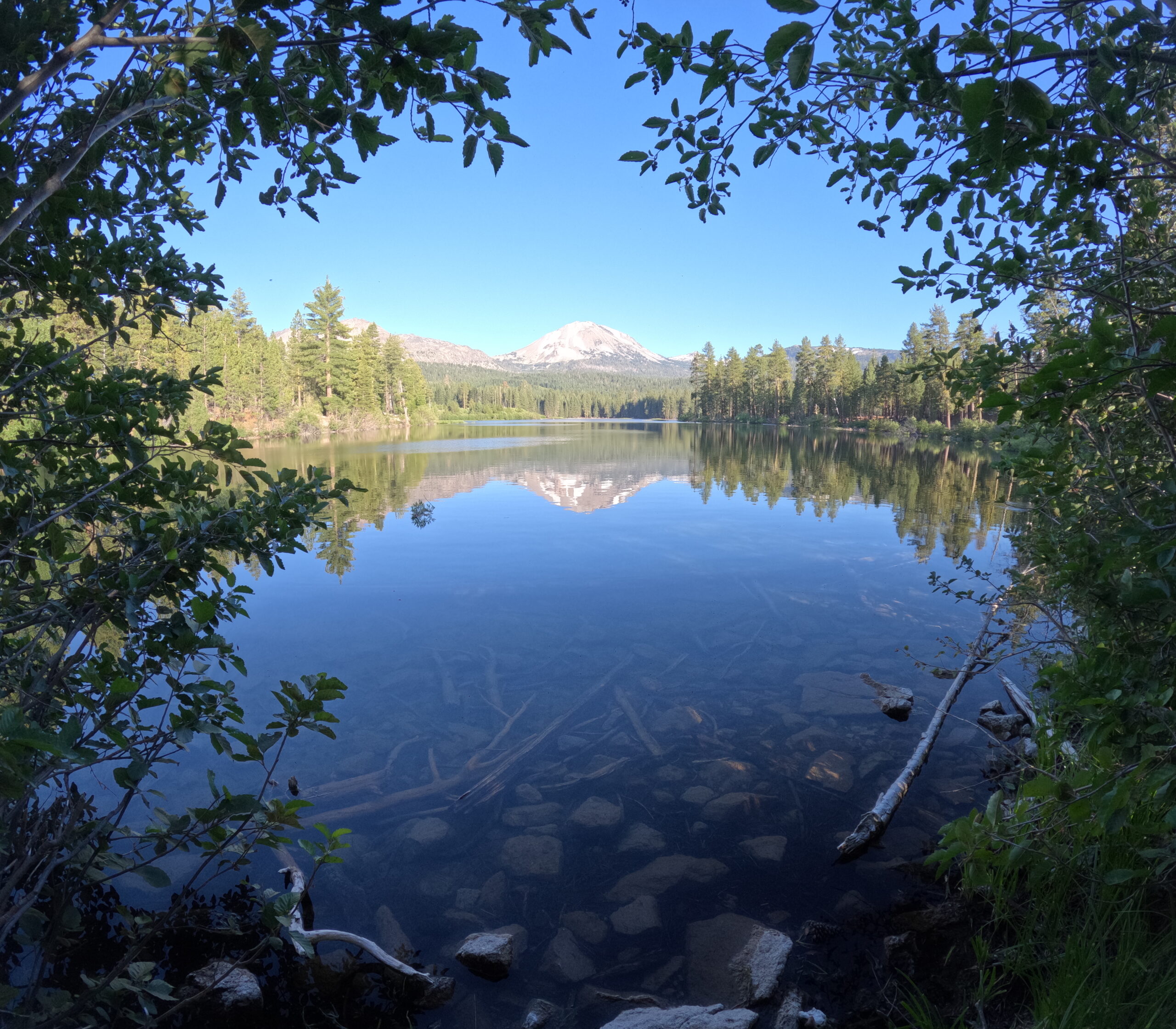
Manzanita Lake
The lake was formed about 300 years ago when rock fall in the Chaos Crags area damned Manzanita Creek. The lake is popular with anglers thanks to its rainbow and brown trout. It was the perfect place for us to have a picnic along the shore.

Take a side trip to incredible McArthur-Burney State Park
The second oldest of California’s state parks is home to Burney Falls, a unique spring fed waterfall that Theodore Roosevelt once called the Eighth Wonder of the World. The park features a great .75 mile trail that begins at a viewpoint overlooking the falls, descends to the base of the falls, and then climbs to the top of the falls.

Click here for more Land of Liberty Explorers! Follow us on Facebook and Pinterest!

