Located 50 miles north of I-94 on North Dakota Highway 85, the North Unit is significantly less visited than the South Unit. It has a 14 mile scenic drive, hiking trails, and unique geological features. We loved exploring this less visited section of the park!

Scenic Drive
The Scenic Drive begins at the park entrance. It is well maintained road that features several viewpoints and parking areas for hiking trails.

Cannonball Concretions
One of the many unique geological features of TRNP’s North Unit are the Cannonball Concretions. The giant round boulders were formed by mineral rich water seeping through the porous badlands soil building the cannonball like a pearl. The Cannonball Concretions are located just off of the Scenic Drive.


Buckthorn Trail Prairie Dog Town
From the Caprock Coulee Trail parking lot, hikers can take the Buckthorn Trail about 1.5 miles to a Prairie Dog Town. We arrived early and were the only hikers on the trail. The prairie dogs started barking to announce our arrival then went about their daily routines. It was fun watching the prairie dogs race in and out of the holes and interact with each other.


Caprock Coulee Nature Trail
This 1.5 mile trail is a good introduction to the geology and terrain of the park. A coulee is a steep narrow valley. Pick up a trail brochure at the trailhead to learn about how geology shaped this amazing landscape.


Riverbend Overlook
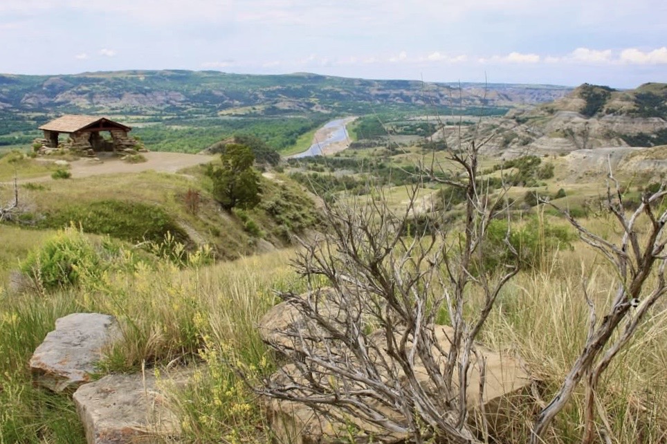
The Riverbend Overlook may be the most scenic viewpoint in the North Unit. It is framed by a shelter built by the Civilian Conservation Corps around 1937.


From the Riverbend Overlook, the Scenic Drive continues to Oxbow Overlook. You may see bison anywhere along this open stretch.


Oxbow Overlook
Oxbow Overlook is at the end of the Scenic Drive and offers a view of a bend in the Little Missouri.


Click here for more Theodore Roosevelt National Park pages!
Click here for more Land of Liberty Explorers!
Like this page? Pin it!

