Overview
Haleakalā is a massive shield volcano that makes up 75% of the island of Maui. According to Hawaiian tradition, the demigod Maui lassoed the sun from the top of the mountain. Haleakalā was originally part of Hawaii National Park, but became its own park in 1976, when Hawaii National Park was renamed Hawaii Volcanos National Park. The park has two districts: the summit and the Kipahulu District. The Kipahulu District lies at the end of the Road to Hāna. The park is known for the silversword – a plant that is not found anywhere else on earth.
Haleakalā Summit
Haleakalā’s highest peak is 10,023 feet above sea level. Be sure to bring a warm jacket. The mountain’s height puts it in the alpine climate zone, so it can be quite cold at the summit. There are several space observatories at the summit including stations belonging to the U.S. Department of Defense and Smithsonian. Most visitors come to the summit to view sunrise or sunset. We drove to the top of Haleakalā on our first night in Maui to see sunset.
Sunset
While not as popular as sunrise viewing, the sunset atop Haleakalā is every bit as impressive. The summit is generally above the clouds providing a unique view of the sun dropping below them.


Sunrise
Accessing the park for sunrise requires a special pass available at recreation.gov. Keep in mind you will need to get up extra early to get to the summit before sunrise because the road to the top is long and windy. There was a much larger crowd at the summit for sunrise when we were there.

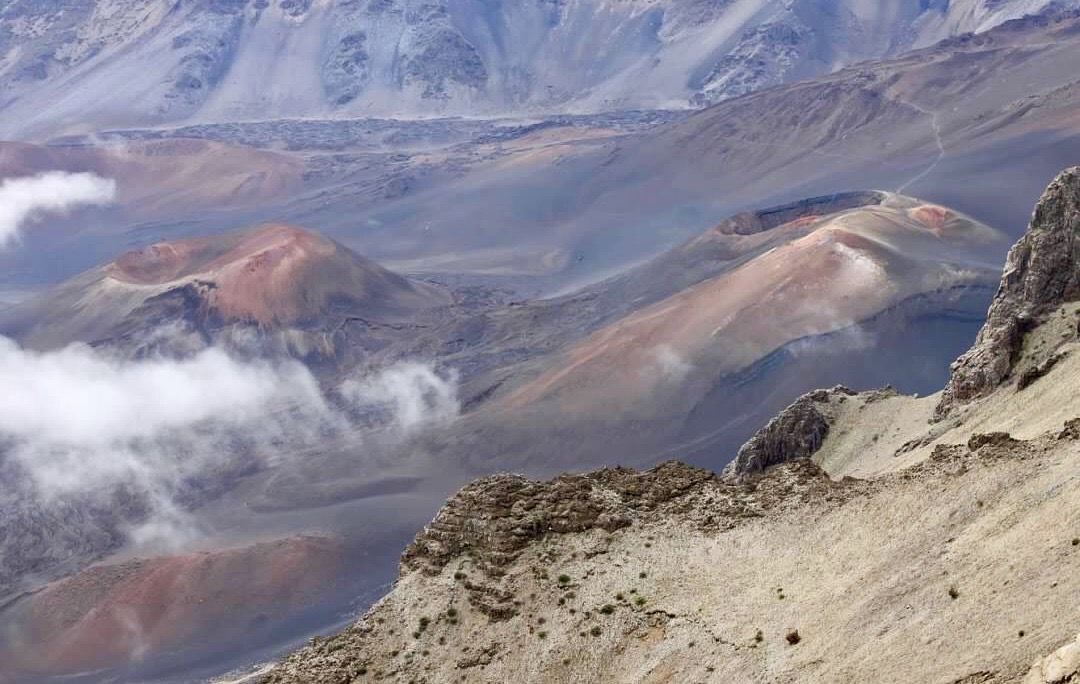
Keonehe‘ehe‘e (Sliding Sands Trail)
While most visitors only stay for sunrise, this hike is a great way to experience more of the park. The trail descends into Haleakalā’s crater. It is about 11 miles one way from the summit to Halemau’u. There is no shuttle back to the top, so hikers that need to get back to the top should plan ahead. As the name suggest, the trail travels through sandy terrain. We hiked out to some interesting views of cinder cones in the crater, then returned to the summit parking area (about 4 miles total). We came across a large field of silverswords on the hike. We really loved this hike!


Hosmer Grove
Hosmer’s Grove is a unique forest just below the summit. Ralph Hosmer planted a variety of trees here in 1904 for the Forest Service hoping to develop a successful timber industry in Hawaii. Today this grove has many non-native species including cedar, spruce, and eucalyptus. The trail through the grove takes about 30 minutes and offers a chance to see various types of honeycreepers!


Kipahulu District
The Kipahulu District lies at the end of the Road to Hāna, about 12 miles outside of the town of Hāna. The two main features of the Kipahulu District are the Pīpīwai Trail and ʻOheʻo Gulch.
Pīpīwai Trail
The Pīpīwai Trail is 4 miles round trip with an elevation gain of 800 feet. Makahiku Falls comes into view a half mile into the hike, and the bamboo forest section of the trail begins about a mile into the hike. The trail was closed for maintenance after the bamboo forest during our visit, so we did not make it all the way to Waimoku Falls.


ʻOheʻo Gulch
ʻOheʻo Gulch is a series of small waterfalls that feed freshwater ponds which cascade down into the Pacific Ocean. The gulch is sometimes referred to as Seven Scared Pools – a name created to help enhance tourism in the area. It is lovely spot to enjoy!

Click here for more of our favorite things to do in Hawaii!
Click here for more Land of Liberty Explorers!
Like this page? Pin it!


