Overview
Great Smoky Mountains is America’s most visited national park! It straddles the Tennessee/North Carolina border. It is the first park to have lands bought using federal funds. It was created by Congress in 1936 and officially dedicated by President Franklin Roosevelt in 1940. The park is known for its impressive biodiversity. Plants in the park give off volatile organic compounds that make the air appear smoky and blue. We spent a long weekend enjoying the park. Here are some of our favorite experiences from our weekend at Great Smoky Mountains.
Roaring Fork Motor Nature Trail
Our first experience in the park was driving the Roaring Fork Motor Nature Trail. The Roaring Fork is a stream that runs down Mount Le Conte. The Roaring Fork Motor Nature Trail begins in Gatlinburg and circles the Roaring Fork Historic District, which preserves historic farmsteads, homes, and mills.

We encountered some of the park’s famous wildlife as soon as we entered the park. We enjoyed seeing a large group of black bears on a hillside. We also saw several wild turkeys.


Historic buildings were scattered along the motor nature trail, including a small mill.


We also took a 2.6 mile round trip hike to Grotto Falls. To get to the falls, park at stop #5 on the motor nature trail and take the Trillium Gap Trail. Grotto Falls is 25 feet tall. The trail actually passes behind the falls! We spotted one of the parks famous salamanders hanging out in the mud near the falls.


Alum Cave Trail
We really enjoyed the 5 mile hike to Alum Cave. The trailhead is located on Newfound Gap Road and has two large parking areas. The trail starts by crossing two log bridges over Walker Camp Prong and Alum Cave Creek before passing through old-growth hardwood forest.


About a mile and a half into the hike, hikers pass through Arch Rock – a huge natural arch with a staircase cleverly built through it. Arch Rock was our favorite feature on this hike!


The trail gets steeper after Arch Rock. Hikers reach Inspiration Point two miles beyond Arch Rock.

From Inspiration Point, the trail ascends on up to Alum Cave. Then it continues up Mount Le Conte, but we turned around at Alum Cave to have more time to explore Newfound Gap Road.

Newfound Gap
At the Tennessee/North Carolina border, Newfound Gap is a beautiful mountain pass. We loved the view of the North Carolina mountains. There are many photo opportunities at this stop – the view into North Carolina, state line sign, and the Rockefeller Monument, where FDR formerly dedicated the park in 1940. Just passed the Rockefeller Monument, there are clean restrooms. The Appalachian Trail intersects Newfound Gap Road here so be on the lookout for hikers.

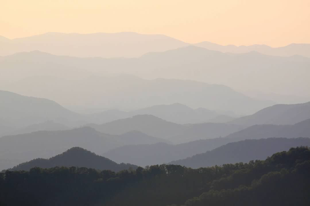
Clingmans Dome
The highest point in the park is capped with a unique circular observation tower built in 1959 as part of the National Parks Service’s Mission 66 – a program to upgrade visitor accommodations for the Post-World War II era. The Appalachian Trail also passes near Clingmans Dome.

We were underwhelmed by our stop at Clingmans Dome. The parking lot was a mess; we sat in traffic for a solid 45 minutes waiting for parking spots to open up. The trail is a short 1.2 miles round trip but very steep; this will spike everyone’s heartbeat. While the observation tower is somewhat interesting, it feels out of place in a park filled with so many historic structures. We liked the view at Newfound Gap better. For that matter, we thought the view from the Clingmans Dome parking lot (left picture below) was better than from the top of the tower (right picture below). We will probably skip Clingmans Dome on our next trip to Great Smoky Mountains.


Mingus Mill
Mingus Mill is located in the Oconaluftee section of the park in North Carolina. The mill was built in 1886 at a cost of $600. It operated from 1886 until 1934 when the National Park Service acquired the land. The mill was restored in 1937. The mill operates by diverting water into its sluice canal. The water then proceeds down a flume to turn a steel turbine that turns the grindstone. Grains are available for purchase when the mill is open.

Oconaluftee Visitor Center & Mountain Farm Museum
The Oconaltuftee Visitor Center is a beautiful complex. The Mountain Farm Museum is located directly behind the visitors center and gives visitors an idea of what life was like in the 1880s.


Elk
Elk originally roamed the area, but they were eliminated by overhunting and habitat loss. A herd of 25 elk were reintroduced into the park in 2001. While most of the park’s elk live in the Chattaloochie Valley in the northern part of the park, several make an appearance behind the Oconaluftee Visitor Center in the evenings. We enjoyed listening to a large bull bulge from across the stream next to the Mountain Farm Museum. Before long, he crossed the stream and walked into the open field on the other side of the museum.


Mingo Falls
Just outside the park, Mingo Falls is a 120 foot tall waterfall located on the Qualla Boundary – a land trust of the Eastern Band of Cherokee Indians. “Mingo” means “big bear” in Cherokee, and this is definitely a big waterfall! The Pigeon Creek Trail leads to Mingo Falls from the Oconaluftee Visitor Center, but we took a short cut by driving through Cherokee, North Carolina and parking at the base of the stairs that lead to the falls. The beautiful public school campus in Cherokee was impressive. Mingo Falls was our favorite waterfall!

Blue Ridge Parkway
The Blue Ridge Parkway ends near the park’s Oconaluftee entrance. We enjoyed the quick drive that featured tunnels and beautiful mountain sunset views.


Cades Cove
Cades Cove is a large valley on the Tennessee side of the park. Before the park was established, the cove was home to numerous settlers. Today, the National Park Service preserves many of the historic log homes, churches, and other buildings built before the park was established. It is the single most visited area of the park drawing over two million visitors per year. Visitors proceed along Cades Cover Loop Road – a narrow, one way road. Be sure to pick up a copy of the park’s Cades Cover Tour booklet ($1) before beginning on the loop road.


We especially enjoyed exploring the John Oliver Cabin (stop #3 in the Cades Cove Tour booklet), Elijah Oliver Place (#10), Cable Mill (#11), and Carter Shields Cabin (#17).


Miegs Falls and the Sinks
These waterfalls are located on the road to Cades Cove. Meigs Falls is visible from a turnout on the road. The Sinks has a small parking area.


Laurel Falls
This trail is incredibly popular, and it was very crowded on the day of our hike. The Parks Service is now experimenting with a timed entry pass system to ensure the trail never gets too crowded. The trail is a 2.6 mile out and back, mostly paved path with areas of steep grade. There are some nice views as the path climbs toward the falls.


The falls is 80 feet high and named for the mountain laurel bushes that line the trail.

Favorite Smoky Mountain Eats
Here are a few of our favorite spots for lunch or dinner!
Preacher’s Smokehouse – This little joint in Sevierville, Tennessee serves up great barbecue and they have a great backstory too. This is a great choice if you choose to visit the large arts and crafts community nearby.
Split Rail Eats – We loved the wide ranging menu at this cute Gatlinburg cafe. Good food after a busy day exploring!
Gatlinburg Brewing Company – GBC has fun artisan pizzas and lots of craft beer options. We picked up a couple pizzas and a crowler to go!


Click here for more Land of Liberty Explorers!
Like this page? Be sure to pin it!

